| The Beach | |
|---|---|
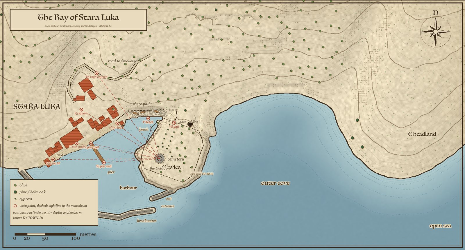 The bay map; the beach lies in the inner corner | |
| Type | Pebble pocket beach |
| Location | Stara Luka, the inner cove head below the shore path |
| Size | 61 × 12 m |
| Added | 2026-09-29 (director) |
| Status | In the terrain (berm carved) |
The Beach
The beach of Stara Luka is a small shingle and pebble pocket beach in the harbour's inner corner, between the town's east edge and the saddle of the Glavica.
Overview
- 61 m long and 12 m deep, a crescent along its waterline.
- A berm at Y 0.4–1.2, the swash to −0.3, then a gentle shelf to −2.5 m within 25 m, so the water is turquoise over pale pebbles.
- A pocket beach forms where a gully's torrent brings shingle into a sheltered corner; this is the calmest water in the harbour.
Life
Three boats pulled up on the berm, nets drying on poles at both ends, a limestone outcrop at each end with sea fennel and sea lavender in the cracks, one or two tamarisks at the back edge, and no plants on the pebbles.
Access
A 7-second walk from the riva's east end, and the shore path to the cemetery runs behind it.
History of the design
The director asked on 2026-09-29: "also add the beach in the town, but dont change something in the town for the beach". Not a single building, lane or square moved for it.
See also
Sources: docs/terrain/island1/stara_luka_bay_plan.md §0, §3; docs/decisions.md (2026-09-29 17:10) Last updated: 2026-09-29 (WIKI-1)
Categories: Locations · Stara Luka