| Breakwater and Mul | |
|---|---|
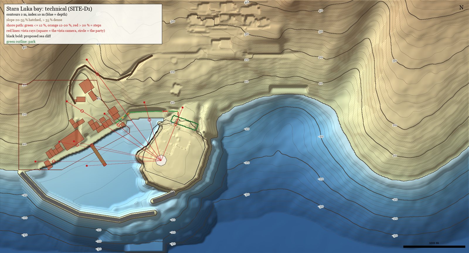 Technical map of the bay | |
| Type | Rubble breakwater (lukobran) and mole (mul) |
| Location | Stara Luka harbour mouth |
| Purpose | Shelter from the jugo (SE) |
| Water depth | All mounds in ≤ 7.7 m of water |
| Status | Planned (TER-HB1 rev 2; built on a reef in the terrain) |
Breakwater and Mul
The breakwater (lukobran) and the mul are the two rubble arms that close Stara Luka's harbour against the jugo, the wet south-easterly wind.
Overview
- The breakwater runs from the western headland's tip. Its planned extension carries its head 36 m further east.
- The mul is a 37 m spur leaving the toe of the Glavica toward it.
- The two heads overlap in a dog-leg with a 19 m gap. Boats come in from the south into the pocket between the moles, then turn west through the gap into the basin.
- With this layout only about 6 % of the basin sees the jugo in a straight line (44 % with the old head alone).
Why it is plausible
A deep-water head in 32 m of water was rejected: a small medieval town couldn't build it. Both moles instead stand on a submerged limestone reef in 7.7 m of water or less, the kind small Dalmatian harbours built on shallow banks. The fallback (the old head only, with boats hauled onto the beach and slip in storms) is also a real practice.
See also
Sources: docs/terrain/island1/stara_luka_bay_plan.md §0, §2; docs/decisions.md (2026-09-29 18:05, 18:15) Last updated: 2026-09-29 (WIKI-1)
Categories: Locations · Stara Luka