| The Glavica | |
|---|---|
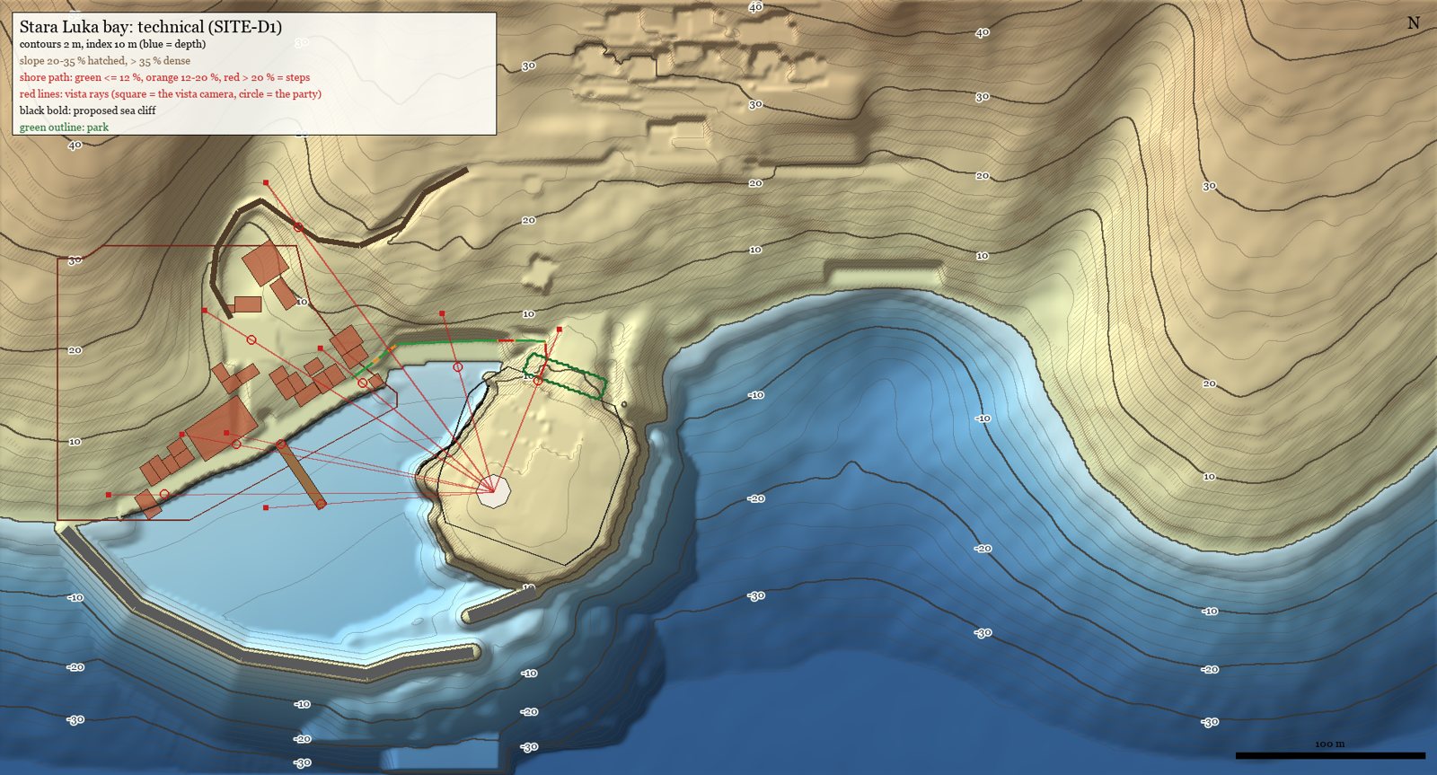 The Glavica closes the harbour on the east (terrain plan rev 3.1) | |
| Type | Limestone headland (knoll) |
| Meaning | Dalmatian for a knoll that stayed high as the rock around it wore down |
| Location | Stara Luka harbour, east arm |
| Height | Crown Y 15–16.5; saddle Y 8; sea cliffs 10–12 m |
| Length | 127.5 m, saddle to tip |
| Affiliation | The cemetery; the dead |
| Status | Built in the terrain (TER-HB1) |
The Glavica
The Glavica is the low limestone headland that closes Stara Luka's harbour on its east side. On its crown stands the Octagon in the middle of the town's cemetery, and beneath it lies the mausoleum dungeon. It is the only place in the demo where the dead walk.
Geography
- It runs from a low saddle on the north shore (Y 8) SSW to its tip, 127.5 m.
- The crown is at Y 15–16.5; the brows at Y 12–14.
- Sea cliffs of 10–12 m fall from the brow to Y 2, then a boulder toe to −4 m.
- The rock is a resistant block of the island's rudist limestone. Its beds dip 12° to the south, so the south face shows sloping ledges; its cliffs are wave-cut, with a notch at the waterline.
- Rain drains off the crown radially over the cliffs. Nothing ponds (karst).
- A doline (a natural collapse funnel) on the east flank opens into the dungeon's cave far below; a fig grows in its throat.
Plants
Cypresses along the funeral walk, old olives on the terraces, a dark grove of holm oak and stone pine on the crown behind the Octagon (so the pale stone reads against it from the town), Aleppo pines leaning away from the wind on the brows, junipers in the cracks, and sea fennel on the toe.
Name
The planners first called it Gradina. On 2026-09-29 it was renamed Glavica, because Gradina is already the name of settlement #4 on Island 1. The lowercase gradina (hillfort) survives in its lore: see The Illyrian hillfort.
Getting there
From the riva's east end the shore path runs behind the beach to the foot of the cypress walk, then up to the cemetery gate: about 130 m, some 40 seconds on foot.
History of the design
The first plan put the cemetery on a far eastern headland about 500 m away. On 2026-09-29 the director asked to "make mausoleum very close to the town", and then for a lower headland ("Lower, 12-18 m"). The Glavica is the result: 80–150 m across the water from the riva and the pier.
See also
Sources: docs/terrain/island1/stara_luka_bay_plan.md §0–§2, §5–§6; docs/towns/island1/stara_luka_cemetery_plan.md §1; docs/decisions.md (17:05, 17:40, 18:05) Last updated: 2026-09-29 (WIKI-1)
Categories: Locations · Stara Luka · Landmarks